
Est. 1984 · Harrogate
Four decades
on the map.
Formed more than 40 years ago, Geoplan has always been at the forefront of putting location data to work.
The Archive
From paper to pixels
Long before the cloud, Geoplan’s data lived in handbooks, wallmaps and ring-binders — the printed objects that mapped a nation.
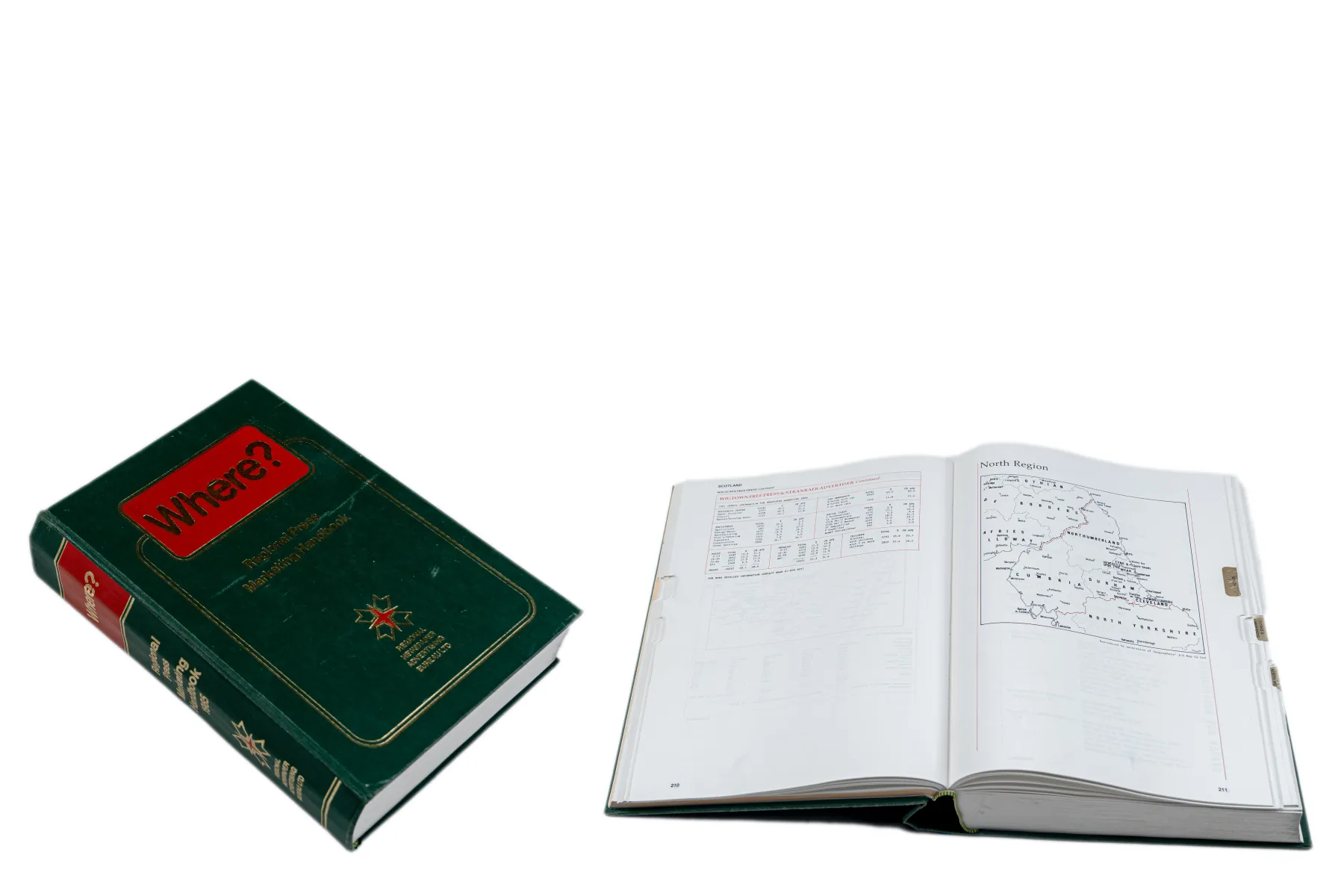
The “Where?” Handbook
Postcode meets census — the Regional Press Marketing Handbook.

Postcode Wallmaps
A full national range, in association with Royal Mail.
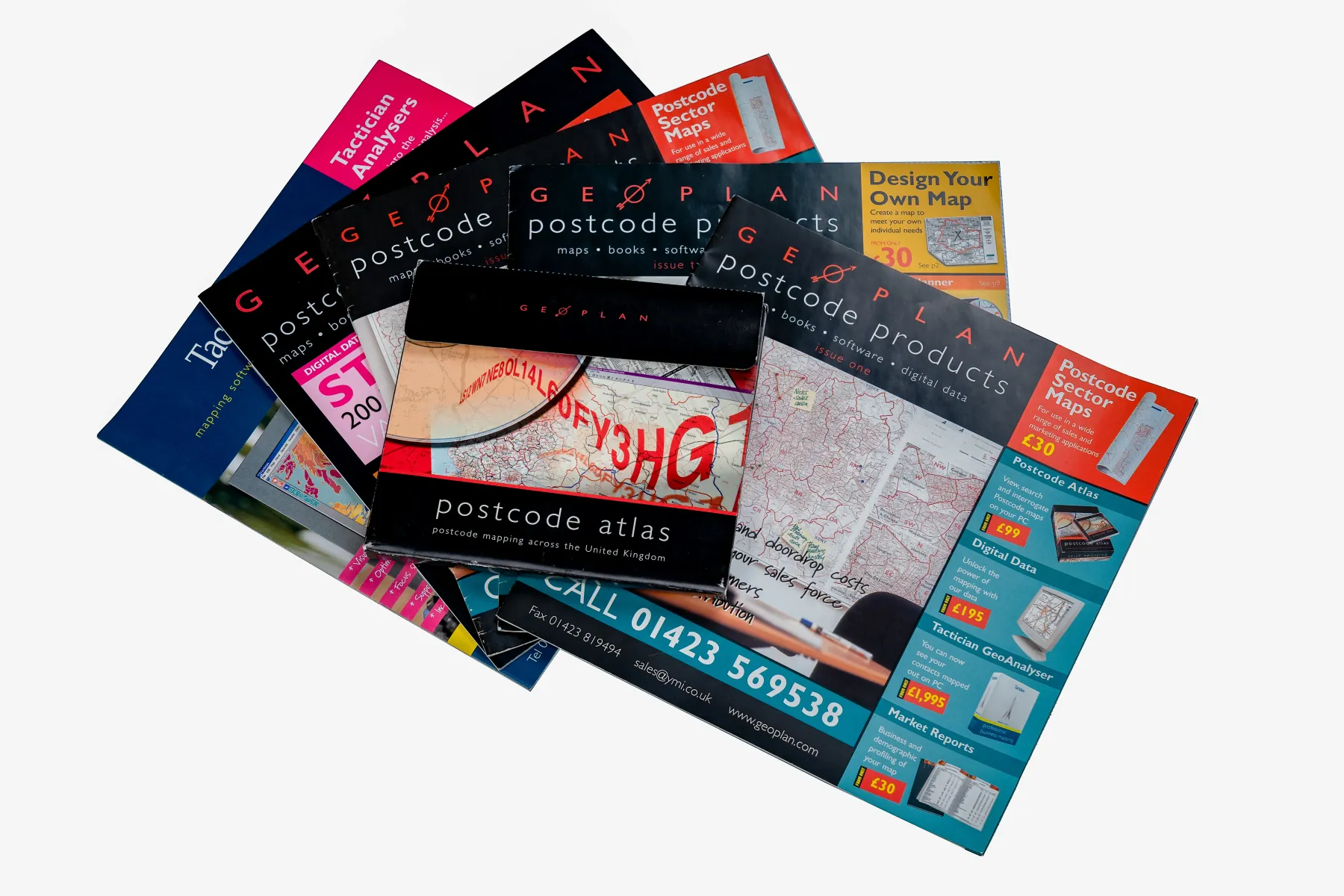
The Postcode Atlas
Maps, books, software — the first national Postcode Atlas.
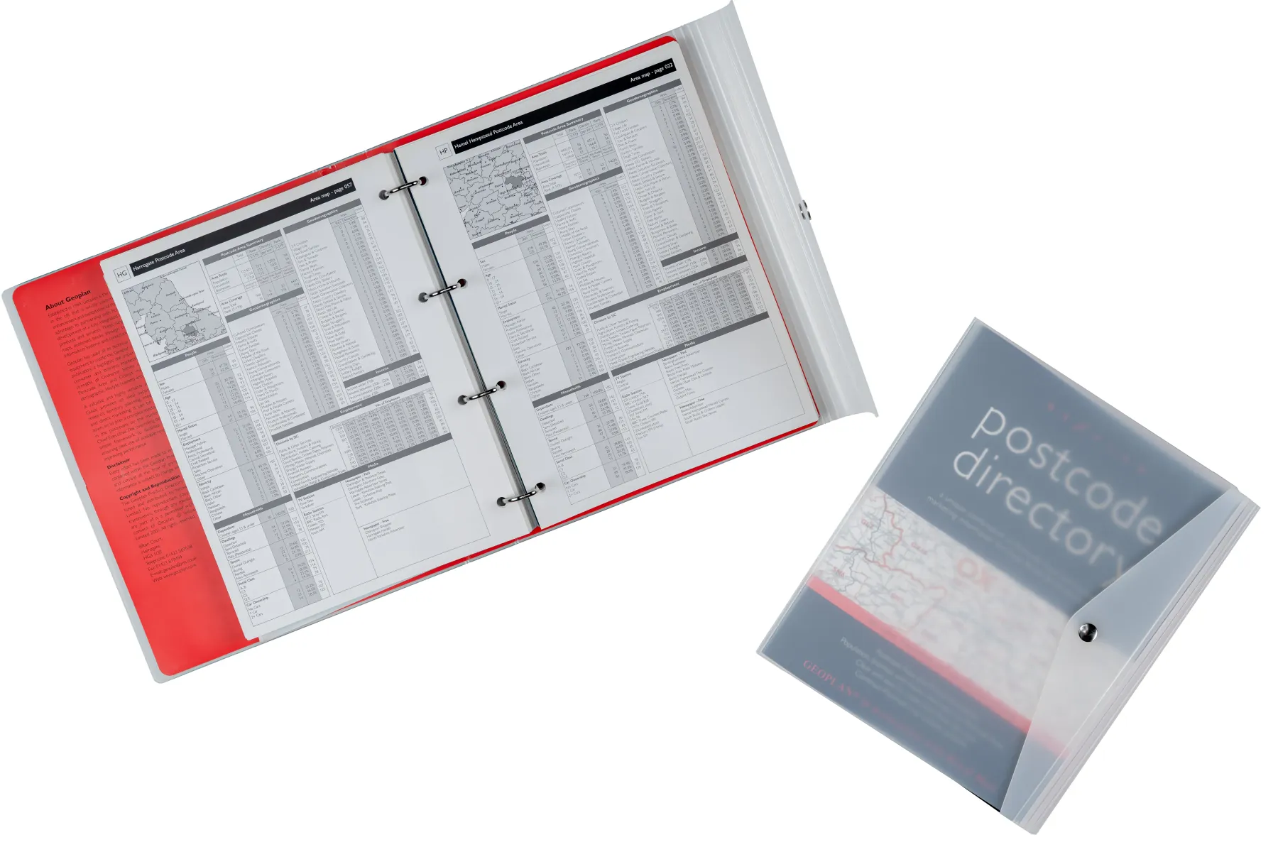
The Marketing Directory
Locate, quantify and target customers by postcode.
UK Postcode Data
The data packs that powered a generation of analysis.
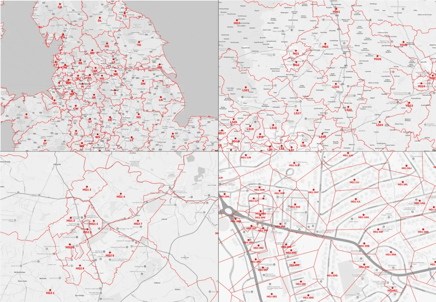
SuperPro Boundaries
Sector boundaries sharpened to 1:10,000, UK-wide.
1980 — 1989
01The Foundations
Before the internet. Before satnav. Putting Britain’s postcodes on the map for the very first time.

The dawn of desktop computing
Desktop PCs become just capable enough to run business applications. Managing large datasets is painfully hard — and moving data means posting floppy disks through the letterbox.
Geoplan is founded — and hand-digitises the nation’s postcodes
Geoplan is established and, in partnership with the Royal Mail, hand-digitises the first National Digital Postcode Boundary set. The file is so large it runs on a mainframe at Birkbeck College, London, under former Ordnance Survey director David Rhind. It produces the WHERE book — pairing postcode and census data — published by the Regional Newspaper Advertising Bureau to plan advertising spatially. An early forerunner of the cloud analysis Geoplan offers today.
Geoplan UK, and a first home in Harrogate
Geoplan UK is purchased and moves into its first building on Regent Parade, Harrogate. The Geoplan (UK) Ltd, Market Profiles Ltd and MWT Ltd group forms — and STP, our first mapping software, is created.

John Taylor joins
John Taylor — Geoplan’s current Managing Director — joins the company.
1990 — 1999
02Mapping the Nation
Becoming the UK standard for postal geography — in paper and in code.
John Taylor buys Geoplan — and it becomes the UK standard
John Taylor buys Geoplan. A joint venture and supply agreement with both the Royal Mail and Ordnance Survey makes Geoplan the recognised industry standard for postal geography, and the sole supplier to Royal Mail in support of its postal operations. A partnership with Boston-based Tactician appoints Geoplan as its European product development and marketing partner for desktop mapping.
A national range of postcode wallmaps
Geoplan launches a full national range of printed Postcode Wallmaps.
The first Postcode Atlas — and a new name
Geoplan publishes its first national Postcode Atlas book. The group becomes known as Yellow Marketing Information Ltd (1995–2005).
The Postcode Marketing Directory
Geoplan publishes a unique Marketing Directory that lets businesses locate, quantify and target customers by postcode — using demographics, business profiles and media coverage.
A business-wide mapping solution for Yell
Geoplan works with Yell to extend the original 1994 single-user project into a business-wide mapping solution — supporting strategic sales operations, key-account planning and point-of-sale media tools.
First steps into software design
Geoplan takes its first steps into software design, releasing its Atlas Mapping Software range — built around ease of use for business customers at a sensible price.
Building Ordnance Survey CodePoint polygons
Geoplan secures the contract to build Ordnance Survey CodePoint polygons.
2000 — 2009
03Going Digital
A new home, hard-won accreditations, and the first web platform — followed by a deal with Google.

Home at Bilton Court
Geoplan moves into Bilton Court — still the company’s UK home today.
Directory and Atlas, combined
A new Geoplan Marketing Directory and Atlas combined — taking the best of the 1995 and 1996 publications.
ISO 9001 and Investors in People
First accredited to ISO 9001 — retained ever since — so that we build efficient processes and deliver consistently high-quality outcomes. First accredited to the Investors in People standard the same year, reinforcing how we improve performance through our people.
Turnover reaches £1.29m
Geoplan’s turnover reaches £1.29m.
TickIT accredited
Geoplan becomes one of only 1,500 companies in the UK accredited to TickIT — retained to date — so that we develop high-quality software and data solutions.
Digital printing, and a culture journey
Geoplan moves to digital printing of maps. A long-running journey of organisational development, operational frameworks and high-performing teams begins.
A National Training Award
Geoplan pilots the Investors in People Leadership and Management Model and wins a National Training Award.

SKiN — the web platform is born
Geoplan designs SKiN (Spatial Knowledge iNterface) and begins building it in-house. Its first step into web-based software, SKiN still underpins the entire product suite today.
Streetfinder Desktop
Streetfinder Desktop is released to support the door-to-door industry with demographic targeting. Turnover reaches £1.62m.

Google for 10 years, TNT across 50 countries
Geoplan wins a 10-year contract to supply Google with its market-leading UK Postcode Boundary products, used to power all UK search. The same year, a global contract with TNT Express creates a new “zonal” delivery and mapping system for depot, vehicle and route planning across 50 countries.
2010 — 2019
04Scaling to the Cloud
Optimisation at national scale, in the cloud, for the world’s biggest carriers.

Hermes, Shire and Territory Optimisation
Geoplan wins a large cloud-based Route Management System project for Hermes, and launches an all-new Territory Optimisation capability — letting customers build sales territories balanced on workload and opportunity. Shire Pharmaceuticals engages Geoplan to build an online mapping system, on industry brick geography, for its ERP/BI systems.
Microsoft Partner; Smith Institute algorithms
Geoplan becomes a Microsoft Partner and partners with ThinkGeo in Dallas to extend SKiN’s core mapping. Accepted as an Investors in People Champion, a status proudly maintained. Work begins with the Smith Institute on bespoke territory and route-optimisation algorithms — the backbone of a new generation of optimisers.
Yum! Site Optimiser — 75 countries
Geoplan secures a contract to deliver Yum! International’s global online SaaS, bringing market assessment and site planning via the newly launched Site Optimiser to 75 countries. Software is adapted for the smartphone era. Turnover reaches £1.66m.
SuperPro Sector Boundaries at 1:10,000
With Cranfield University, Geoplan designs and builds SuperPro Sector Boundaries — improving postcode sector boundary scale from 1:50,000 to 1:10,000, UK-wide. A two-year partnership with Answer Consulting furthers the product suite.

Parcelforce route optimisation, in the cloud
Geoplan secures a significant contract to deliver cloud-based route optimisation to Parcelforce Worldwide, a market leader in UK pick-up and delivery. TNT Express commissions Geoplan to transition the 2009 systems to the cloud.
DRM — the Demand Responsive Matrix
Geoplan designs and builds DRM (Demand Responsive Matrix) — flexible routing coverage, shifts and waves based on daily demand, for logistics and final-mile route management.
ISO 27001, Payment-by-Postcode and Cyber Essentials
First accredited to ISO 27001 (retained since) keeping data security at the top of the agenda. Geoplan designs Payment by Postcode (PBP) for owner-driver fleets, and achieves Cyber Essentials Plus — adding a further layer of assurance for customer data.
Sharper optimisation algorithms
Further refinement of the territory and route-optimisation algorithms, in partnership with the Smith Institute. Turnover reaches £1.84m.
Variable Stop Time, and Royal Mail
Geoplan designs Variable Stop Time (VST) — configurable visit times by building and work type, applied to route scheduling with time windows. Geoplan secures a contract to supply Royal Mail with depot and route-optimisation capabilities as it expands into parcels. R&D spend reaches £4.03m.
2020 — 2026
05The Platform Era
Resilience, cloud-native delivery, and a platform built for an AI age.

Resilience, AWS and self-serve
Geoplan designs a Unit Postcode Polygon Boundary product for Northern Ireland. A business-continuity plan meets COVID head-on, with a seamless move to hybrid working and no drop in service. Significant AWS cloud upgrades bring enhanced security, resilience and performance — and Geoplan opens self-serve trial and purchase for worldwide access. A major programme of platform architecture and UI/UX design begins.
Investing in people and place
A renewed focus on people development — significant investment in leadership and technical skills — alongside a full office refurbishment to support new ways of working.
The next platform takes shape
Investment in the platform and people continues as the next-generation, cloud-native SKiN takes shape — ahead of its major 2023 release.
A major leap for the cloud platform
A major development of the cloud-based platform — improving performance, capabilities and data — delivered through Geoplan’s SaaS.
End-to-end, made simple
Development continues with end-to-end services focused on generating results in simple, easy-to-understand steps.
Four decades, by the numbers
0+0+ Years of experience
0k+0k+ Satisfied customers
0%0% Delivered right first time
0%0% Business through customer referral
0%0% Mileage and fuel costs savings
00 Key decision pays for the Platform
1984 — and counting
The story continues.
From hand-digitising the nation’s postcodes to a cloud platform built for an AI age — the mission has never changed: help people make better decisions with location data.